FORCED DISPLACEMENT
Finding 3: Short-term responses
Local government response to displacement is focused on the short-term and single hazards.
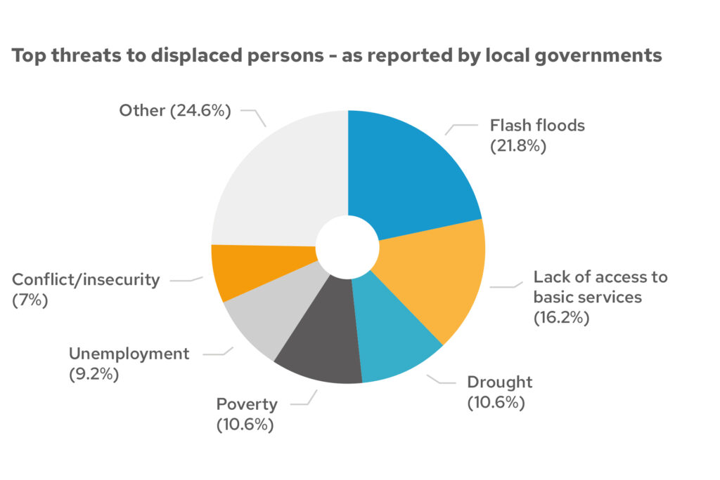
The perceived largest threats or risks by local governments are dominated by hazards such as flash floods (21.8%), drought (10.6%), and conflict (7%). This could be an indication of their more detailed knowledge of hazards in the area and their mandate to respond when hazards become disasters. Those displaced because of poor economic conditions have highlighted flash floods (27%) and drought (13%) as their biggest perceived threat.
Key threats
Those displaced by disasters, social hazards and ‘other’ have cited a lack of access to basic services (20%), flash floods (15%), poor sanitation facilities (14%) and poverty (11%) as key threats, but also remain concerned by the threat/risk of ongoing conflict and insecurity.
Different perspectives on threats to displaced persons
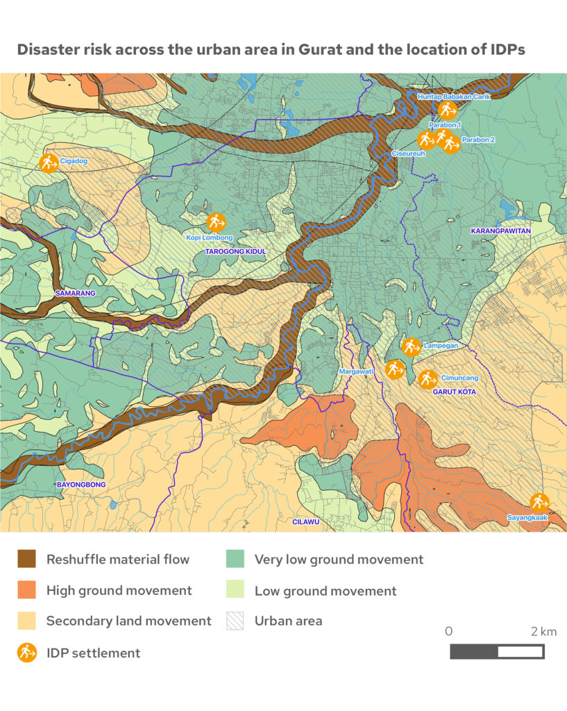
This highlights that there is a clear difference of opinion between local government representatives and displaced populations on the threats facing them, and who are dealing with challenges long after the main event. The map above highlights government relocation in Indonesia due to flooding, but leaves populations at risk of new hazards as they are now living on ground with dangerous material flow.
“Local authorities and civil society have the same conception on the priority threat, however, the community does not share this opinion. They also agree that the distribution of emergency equipment and survival kits, as well as disaster preparedness, remain a good opportunity for reducing the vulnerability of communities… there is weak governance – a lack of policies to strengthen the resilience of communities in the face of risks and a lack of significant budget allocated.”
GNDR member in Congo
Global Finding 4: Climate change increases risk
Next chapterForced Displacement Global Paper
ContentsCredits
Main photo: A mother and young child receive donations at a local shelter after Mount Agung, Bali, Indonesia, erupted forcing villagers to flee into makeshift shelter centres. Credit: Mark Chaves on Unsplash
Pie chart: Community-level data from our Making Displacement Safer programme.
Map: Produced by MapAction. Created 07/07/2021. Supported by the Bureau of Humanitarian Assistance. Data sources: RDI, OpenStreetMap. The depiction and use of boundaries, names and associated data shown here do not imply endorsement or acceptance by MapAction or GNDR.
Project funded by
United States Agency for International Development

Our Making Displacement Safer project is made possible by the support of the American People through the United States Agency for International Development (USAID) – Bureau for Humanitarian Assistance. Content related to this project on our website was made possible by the support of the USAID. All content is the sole responsibility of GNDR and does not necessarily reflect the views of the USAID.
Visit their websiteBecome a member
Membership is free and open to all civil society organisations that work in disaster risk reduction or have an interest in strengthening the resilience of communities.
Join GNDR